Post-tropical cyclone Isaias pushed deeper into the US Southeast on Tuesday, spreading the risk of flash flooding and damaging winds well beyond the Gulf Coast, according to the National Hurricane Center.
The system was moving over southern Alabama and was located about 88.5km south-southwest of Montgomery, with maximum sustained winds of 100km/h, the NHC said.
Forecasters expect Isaias to keep weakening, but warned it will still whip up gusty conditions far inland before dropping below gale force later, the agency said.
Isaias had slammed into the US Gulf Coast with heavy rain and strong winds as it came ashore in northwestern Florida, the NHC reported.
“Isaias makes landfall near Destin, Florida,” the centre said in an earlier update.
“Life threatening storm surge impacting Gulf Coast as dangerous hurricane conditions and flash flooding spread inland,” it added before downgrading the system to a post-tropical cyclone.
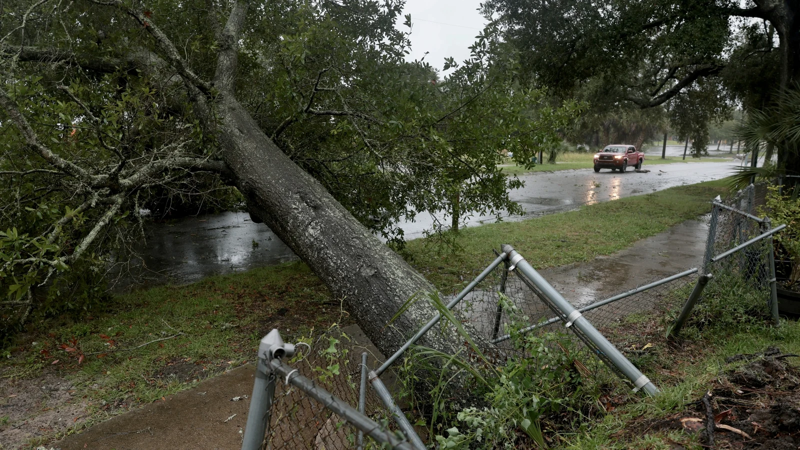
After reaching the coast, Isaias quickly shed strength — weakening to a Category One storm after making landfall near Destin, then falling further into a post-tropical cyclone, the NHC said. Even so, officials cautioned that storm surge and flooding remained dangerous as power lines and connections were knocked out.
Florida emergency services urged residents to shelter in place and remain alert for hurricane conditions across the state’s north, after Isaias first hit land as a Category Two storm.
Along the coast, mandatory evacuations were ordered and businesses were boarded up as Isaias became the first hurricane of an Atlantic season that began in June — a season slowed by a historic El Niño pattern that typically favours more major storms in the Pacific.
In Pensacola, about 80 kilometres west of Destin in Florida, winds were seen tearing roofs from some homes and businesses, snapping tree branches and cutting electricity.
Debris on an intersection as wind and rain from Hurricane Isaias pass through Pensacola in Florida
“Things are flying really fast and I’ve never seen wind this fast before, so it’s intense, it’s scary,” Jonathan Ramos, a 40-year-old government employee, said at his hotel in Pensacola, where the power went out.
“I don’t recommend people coming down here for fun to do this,” he added.
As the storm came ashore, nearly 380,000 people in Florida and more than 210,000 in Alabama were without power, according to Poweroutage.us.
Before the worst conditions arrived, caravans of repair trucks rolled through Pensacola and Navarre to staging areas in anticipation of widespread outages, reporters on the scene said.
Water service to buildings was suspended.
Fuelled by record-warm Gulf waters heated by climate change, Isaias rapidly intensified and became the first hurricane to strike the US mainland since Milton in 2024.
Florida Governor Ron DeSantis said in a briefing that “we’ve got a massive amount of supplies and personnel ready to respond once the storm hits”.
US President Donald Trump cancelled his planned visit to a college football game between the University of Georgia and the University of Alabama in Tuscaloosa, Alabama, because of the hurricane.
Mandatory evacuation orders remained in force in several Florida counties, while forecasters said impacts would be felt across a broad swathe of the southeastern United States.
Storm surge combined with the tide could inundate normally dry ground, with the NHC warning that water could rise as high as 2.7m near the Alabama-Florida border.
Forecasters also warned that torrential rain could spark flash flooding and send rivers over their banks.
Two airports in northwestern Florida have suspended operations.
A man puts shutters on his home before the arrival of Hurricane Isaias in Pensacola, Florida
Isaias’s late emergence this season has been tied largely to an El Niño of historic strength.
El Niño, the warm phase of the El Niño -Southern Oscillation (ENSO), produces strong vertical wind shear over the Atlantic that tends to rip storms apart.
“We have been seeing basically nearly record strong shear throughout the Atlantic Basin this year and that is consistent with what we’d expect to see with a strong El Niño event,” Michael Fischer, of University of Miami’s Rosenstiel School of Marine, Atmospheric and Earth Science, said.
In the Pacific, the same pattern has the opposite impact, reducing shear and helping storms strengthen.
The Pacific has already generated several hurricanes this year, some reaching maximum Category Five intensity.
“Sea surface temperatures in the Gulf of Mexico are in record territory because of fossil fuel-driven climate change,” Marc Alessi, a climate scientist with the Union of Concerned Scientists, said.
“Isaias was able to tap into all of that energy in the ocean to develop into a major hurricane,” he added.
Climate Central said in an analysis that Gulf waters are about 1.4C above the pre-industrial average, and that Isaias “formed over waters that were 600 times more likely to be that temperature because of climate change”, according to Kristina Dahl, the nonprofit’s vice president for science.
Ms Dahl also said storm surge is worsened because climate change has lifted sea levels by around 16cm in the region, meaning surge builds on a higher baseline.
Heavy rainfall, she added, is also connected to warming because hotter oceans and air allow hurricanes to carry more moisture.
Isaias has also interrupted oil and gas output in the Gulf of Mexico, prompting evacuations from platforms and rigs.
About 71% of the region’s oil production was temporarily shut in — nearly 1.5 million barrels a day removed from the market — according to the Marine Minerals Administration.
About 59% of gas production was also suspended.